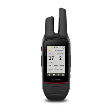
GPS de 2 vías con cámara y mapeo TOPO Garmin Rino® 755t
Consultar tiempo de importación y entrega.
Vea nuestros productos en stock.
DIMENSIONES FÍSICAS 2.6 "x 7.9" x 1.6 "(6.6 x 20.1 x 4.1 cm)
TAMAÑO DE LA PANTALLA 1.53 "x 2.55" (3.8 x 6.4 cm); 3.0 "diag (7.6 cm)
RESOLUCIÓN DE PANTALLA 240 x 400 píxeles
PANTALLA TIPO 3.0 "transflectivo, 65K color TFT
PESO
12.3 oz (348 g) con batería
BATERÍA extraíble, batería de iones de litio recargable
VIDA ÚTIL DE LA BATERÍA hasta 14 horas (hasta 18 horas con la batería AA opcional a 2 vatios)
CLASIFICACIÓN DE AGUA IPX7
MEMORIA / HISTORIA 4.5 GB
POTENCIA DE TRANSMISIÓN 5.0 vatios, GMRS
RECEPTOR DE ALTA SENSIBILIDAD
INTERFAZ compatible con USB de alta velocidad y NMEA 0183
Mapas y memoria
MAPAS PRECARGADOS sí (topográfico)
CAPACIDAD DE AGREGAR MAPAS
BASEMAP
ALMACENAMIENTO Y CAPACIDAD DE ENERGÍA Tarjeta microSD ™ (no incluida)
PUNTOS DE RUTA / FAVORITOS / UBICACIONES 10,000
RUTAS 250
REGISTRO DE PISTA 20,000 puntos, 200 pistas guardadas
Sensores
ALTÍMETRO BAROMÉTRICO
COMPASS Sí (3 ejes con compensación de inclinación)
Características de recreación al aire libre
CÁLCULO DE ÁREA
RUTA AUTOMÁTICA (VUELTA POR RUTA EN CARRETERAS)
GEOCACHING-AMIGABLE
CALENDARIO DE CAZA / PESCADO
INFORMACIÓN DE SOL Y LUNA
CÁMARA
sí (8 megapíxeles con enfoque automático; zoom digital 4x; geoetiquetado automático)
VISOR DE IMAGEN
Funciones de radio bidireccionales
FRECUENCIA BANDA GMRS
CANALES 22
CÓDIGOS DE SQUELCH 38 (CTCSS); 83 (DCS)
ALCANCE Hasta 20 millas sobre GMRS
VOX (ACTIVACIÓN DE VOZ)
INFORME DE UBICACIÓN (ENVIAR Y RECIBIR POSICIONES GPS)
ALERTA DE VIBRACIÓN
RADIO DE TIEMPO NOAA
Adicional
ADICIONAL
Contactos: 50
Segmentos del mapa: 15,000
Receptor GPS de alta sensibilidad con WAAS compatible con HotFix® y GLONASS: sí
Geocaching Live: sí
Soporte de clima activo: sí
Compatible con Bluetooth® ANT + ®: sí
Imágenes satelitales BirdsEye: suscripción de 1 año incluida
Mapas personalizados compatibles: sí
Se carga a través de un mini USB estándar